


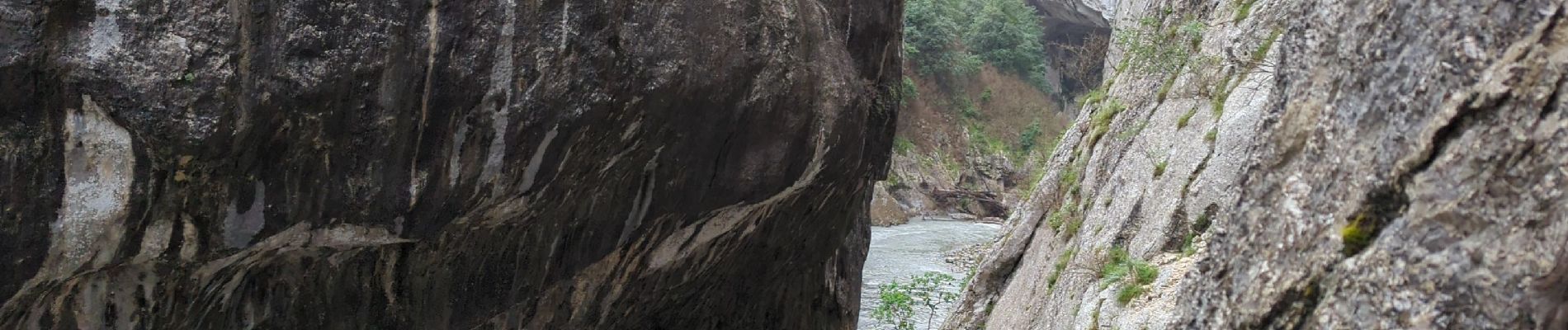
Sentier Blanc Martel

MarcLEBARON
User
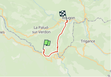

Length
14.3 km

Max alt
931 m

Uphill gradient
1028 m
Km-Effort
28 km

Min alt
556 m

Downhill gradient
1121 m
Boucle
No
Creation date :
2023-06-13 06:44:43.475
Updated on :
2023-12-03 15:28:54.783
4h15
Difficulty : Difficult

FREE GPS app for hiking
 SityTrail
IGN / Geographical institutes
SityTrail Plus
The world is yours!
About
Trail Walking of 14.3 km to be discovered at Provence-Alpes-Côte d'Azur, Alpes-de-Haute-Provence, La Palud-sur-Verdon. This trail is proposed by MarcLEBARON.
Photos


Positioning
Country:
France
Region :
Provence-Alpes-Côte d'Azur
Department/Province :
Alpes-de-Haute-Provence
Municipality :
La Palud-sur-Verdon
Location:
Unknown
Start:(Dec)
Start:(UTM)
286296 ; 4847189 (32T) N.
Comments